Description
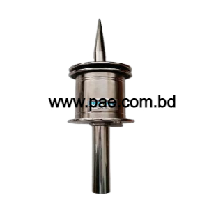
Ellips Lightning Protection System in Bangladesh
The presence of unstable, moist, and warm air masses gives rise to the formation of cumulonimbus storm clouds. This type of cloud is very extensive, both horizontally (about 10 km in diameter) and vertically (up to 15 km). Its highly characteristic shape is often compared with the profile of an anvil of which it displays the upper and lower horizontal planes. The existence of extreme temperature gradients in a cumulonimbus (the temperature can drop to -65 °C at the top) generates very rapidly ascending air currents and results in the electrical energization of the water particles. In a typical storm cloud, the upper part, consisting of ice crystals, is normally positively charged, whilst the lower part, consisting of water droplets, is negatively charged. Consequently, the lower part of the cloud causes the development of electrically opposite charges (i.e. positive over the part of the ground nearby).
Ellips Lightning Protection System
Thus the cumulonimbus formation constitutes a sort of huge plate /ground capacitor whose median distance can often reach 1 to 2 km. The atmospheric electrical field on the ground, about 600 V/m in fine weather is reversed and can reach an absolute value of 15 to 20 kV/m when a ground discharge is imminent (the lightning strike). Before and during the appearance of the lightning stroke, discharges can be seen both within the cloud and between clouds.
It is impossible to discern the individual phases of lightning Protection by simple visual observation. This can only be done with high-speed cameras. Most lightning bolts exhibit the following phenomena: a leader leaves a point in the cloud and travels about 50 m at a very high speed of around 50 000 km/s.
Additional Information
Weight: 1.86 kg
Packaging: 215*215*220 mm
Protection Area: 63-89 m at 5 m